Saturday 31 July 2010

Set up 3


This is the Control Office. I had to wait until ten o clock at night to take this, and then wear a mobile radio to take calls whilst typing, because this place has been MANIC!! 

Even as I type, two members of the night crew are sorting through torches and batteries to begin their first overnight shift; keys and radios are being signed in and we are waiting for the electrical contractors to come and sort out an electrical hookup for a team member whose son has a disability.

Pretty typical then really! :)

Friday 30 July 2010

Set up 2

Empty fields! these are the 'before' photos!

The building in the back is the main Meeting Place.


and looking towards the Youth venue (Thirst)


and looking towards the Empower building.

Thursday 29 July 2010

Set up 1

Going live! Wednesday was a beautiful morning, so what's new on site?

A smart new patio area just outside the Control Office window.


'Impact', the new location for Venue 2 (the Urban Stream).


Seminar venues in the making...


...and the younger kids venues ready constructed.

Wednesday 28 July 2010

2008 continued


The main adult celebrations happen here. In Showground parlance, this is the George Stephenson building. We call it the Meeting Place.


and the other high traffic area is the food court.

But, I spend much of my time in here...


...pretty much behind the scenes!

I think they've fixed the roof now :) But the orange blobs are still there! Never mind. Once I'm behind the 'desk' (bar) I can't see them. Hehehe!!

Tomorrow, we should have internet up and running and I hope to go live.

Tuesday 27 July 2010

Followed by a much drier year

2008 was much drier. It was also my first year out of the main adult venue (where I had been an Usher) and into the Control Office. To be honest, when the Chief Steward rang me, I was slightly hesitant about making the move. I had enjoyed the face to face stuff with the delegates and the atmosphere of the main meetings. I wasn't sure that I would like being in an office all week and, frankly, the thought of operating the radio scared me silly! (I don't mean the mechanics of operating it because a two year old could manage to do that, I mean the 'knowing what to say after you've pressed the button' bit!)

Anyway, that was where the need was, so I thought I'd give it a try. After all, I reasoned to myself, I could always swap back next year if I hated it!

Swap back..? NO WAY!! I loved it! The Control Office is the communication hub for all of the teams and everything goes through us. I took to the radio like a duck takes to water and couldn't wait to get on shift each day! And so that is where I have been ever since, gradually taking on more responsibility as I have become more experienced.

For inside the Control Office, look here, but these are a few rather prettier ones from outside in the early morning sunshine :)


People enjoying living in community.


and this is always home for the week.

Monday 26 July 2010

The wet year!

Tomorrow, I head off for set-up! Around 6,000 delegates are expected to register into the New Wine Conference on Saturday and there's a little bit of preparation to do before they arrive!

For those who haven't a clue what I am talking about (probably quite a few of you), I explained a little bit here, but this one makes it much clearer. My boys grew up with annual trips to New Wine South, but these days, the one I do is North and East, while the boys choose between joining me or doing the Soul Survivor Conference (for youth) at a slightly different time.

During the Conference, I'm hoping to post a daily photo, but I'm starting off with a couple of days of tasters from 2007 (today) and 2008 (tomorrow). I have no pics for 2009, so I'm thinking that I must have been too busy to want to bother. This year, I'll make sure I do!!

2007 was the wet year! It was my second time on team, though the first time on the Newark-on-Trent site. Because of the dates, the boys and I travelled straight from school on the Friday night. The journey was through torrential rain and we arrived to find our camping 'village' four inches deep in water! Ben spent the night in a tent with a friend who was pitched on slightly higher ground, while Mark and I joined 40ish other 'refugees' in one of the permanent buildings; seen here on the sunny day!


Unfortunately, my airbed deflated at about 1a.m. and it's hardly considerate to start blowing it up again with so many sleeping bodies all around. Under the layer of carpet, that concrete floor was rock hard!!

Next day, we set up in a new location on one of the 'high' points of a pretty flat site. I think we came off fairly well overall...


...though you can see the mud.

Some villages were much worse off...


and...


but the kids still managed to have fun!


and the full programme of events went ahead, so everyone made the most of it!

Sunday 25 July 2010

N.Y.M.R


The North Yorkshire Moors Railway carried more than 350,000 passengers in 2009, possibly making it the busiest steam heritage railway in the world. It runs for 18 miles between Pickering to the south and Grosmont to the north and is operated  by a mainly volunteer workforce of engineers, firemen, drivers, guards, signalmen, station masters, caterers, shop assistants, museum curators... There are opportunities for all kinds of service for those who love the world of steam!

There is no question in my mind that these huge engines have much more personality than their modern diesel and electric counterparts. The sounds and smells of the steam engine are a feast for the senses. There is an awareness of the power contained within, waiting to be unleashed; like a tethered dragon fizzing and hissing, snorting and screeching with fire raging in her belly!"

There are other attractions, apart from steam, which help to make the line popular. For the walker, it offers easy access to the moorland footpaths, visitors love to explore the stone built Yorkshire villages, Pickering is an attractive market town and there is now a steam-operated extension to Whitby and the seaside.


In addition, the station of Goathland is famous as Aidensfield in the British Yorkshire TV series Heartbeat and doubled up as the station Hogsmead in the first ever Harry Potter film 'Harry Potter and the Philosopher's Stone'. Imagine a very young Daniel Radcliffe standing here overshadowed by the towering bulk of Robbie Coltraine.

Saturday 24 July 2010

Moors


Inland from the Yorkshire coast are the moors. The North Yorkshire Moors are the largest expanse of heather moorland in the UK and the colour is spectacular when the heather is blooming in late summer; a sea of purple visible even from great distances.

The N Yorks moors cover an area of around 554 square miles, stretching from the coast in the east, to Teeside in the north, the Vale of Mowbray to the west and the Vale of Pickering to the south. A large part of this is designated as a National Park, having been granted this status in 1952 through the National Parks and Access to the Countryside Act of 1949.

The Moors are a wonderful place to walk, They have a feel of being untamed, even though they are mostly managed or farmed. I always have a sense of being out in the wide open spaces and away from the clutter and pressures of daily life. They are like a breath of fresh air after a crowd filled room, with the main companions being sheep and larks.


This particular sheep is a Swaledale and she was very intrested to see whether we might be bringing something edible for her.

Odd to think that, around 200 million years ago, this whole area would have been a tropical sea. The shale (from which the alum can be extracted) and the sandstone are accompanied by limestone which formed from the dead bodies of shell fish and belts of coral. In more recent years (geologically speaking) ice ages have formed glaciers and caused floodwaters, which have gouged out the areas of lowland surrounding the moors. The Vale of Pickering was, for example, once a vast lake.

Today, the moors are drained by the rivers Esk and Derwent (Derwent, Yorkshire; not to be confused with the completely separate Derwent, Derbyshire). The Esk flows out into the North Sea at Whitby, while the Derwent pursues a more southerly course, eventually flowing into the River Ouse.

Friday 23 July 2010

...and lighthouse


I love to see the rock formations eroded by the constant battering of the sea against these chalk cliffs.


Flamborough head is a prime example of an essential location for a lighthouse. On some days, it is open to the public; unfortunately, not the day we visited. If I go again, I want to go up!

This is not the first lighthouse atop this cliff. The first one was a beacon light, dating back to around 1674. It is still in place, slightly further back on the cliff, and is the only known example in England!! If I'd known that while I was up there, I would have definitely taken a photo. Instead, I'll have to content myself with offering you this - taken on a rather less wild day. The interesting (and quirky; in fact downright odd!) thing about this light beacon is that it's believed to have never been kindled! Wha...?!!

The current lighthouse was designed by Samuel Wyatt and built in 1806 by John Matson of Bridlington. It is 85 feet tall. He built it without the use of scaffolding and lived to tell the tale! (Which also strikes me as a slightly odd thing to do. - the lack of scaffolding that is, not the living; which is usually rather sensible). It cost £8,000 to build and was first lit on the first of December in the year it was built. The light itself was oil burning and the shaft rotated so that the light shone through 3 reflective windows; two with white glass and one with red. This made Flamborough the first ever lighthouse to display two white flashes followed by a red.

Electricity was installed in 1940 and an electric fog horn added in 1975, ending the need to send up a rocket flare at five minute intervals during foggy weather. In 1996 the lighthouse was automated, the last ever keeper leaving on 8th May of that year. I know it's more efficient and that being a lighthouse keeper was really a lonely and dangerous task, but my head is still full of the storybook image of the keepers of lights and I find the automation rather sad. Nowadays, the light is controlled from HQ at Harwich (miles away; not even in Yorkshire!). Oh well.

PS: Forgot to mention that the signal, these days, is four white flashes every 15 seconds! (just in case you're ever ambling up the Yorkshire coast on a boat in the dark!)


Thursday 22 July 2010

F is for Flamborough Head


A little further down the Yorkshire coast is Flamborough Head. Designated a Heritage Coast in October 1979, this chalk headland is one of the most prominant featues of the East coast, jutting miles out into the North Sea, with the village of Flamborough at its centre.

As you can see, we visited here on a wild, windy day with the waves pounding against the base of the cliffs and rushing up the gullies and inlets. The spray was flying and the water churning, so that it became white with foam. It was an exhilerating walk battling against the force of the wind and hearing the sounds of the sea raging. Nature at it's raw unfettered best!


It reminds me of the first stanza of the poem by James Reeves:

The sea is a hungry dog,
Giant and grey.
He rolls on the beach all day.
With his clashing teeth and shaggy jaws
Hour upon hour he gnaws
The rumbling, tumbling stones,
And 'Bones, bones, bones, bones! '
The giant sea-dog moans,
Licking his greasy paws.

If you would like to read the rest of this poem, click here.

For the time being, this is the last of Jenny Matlock's Alphabe-Thursday classes. In the words of Alice Cooper, 'School's out for summer!' but we will be picking up again after a short recess involving the colours of the rainbow.

It's been a great meme to be involved in and I've read some classy, funny, whacky, informative, sad and just plain good posts! I'm only sorry I didn't join until 'Q'!

If you would like to sample some posts from this weeks Alphabet Soup finale, follow this link.

Wednesday 21 July 2010

St Oswald's


Just a few miles south of Scarborough is Filey, a much smaller and quieter town which became a resort in Edwardian times. The Cleveland Way ends here. More acurately, the Cleveland Way ends at a stile slightly north of Filey Brig (which is a rocky headland above the town itself). The reason for the sudden (and rather unremarkable) end of the path is that this marks the border of the old North and East Ridings of Yorkshire. In reality, of course, walkers treat Filey as the end.

Filey has a five mile stretch of sandy beach, but my main memory of Filey from 1990, is of the park. I can't remember what it was called and I am struggling to find anything other than the golf course on the map today, so maybe it has changed hands. It was certainly large and open, with a pitch and putt course and that is what we did! After two weeks of walking, we celebrated the end of our holiday with a game of pitch and putt. We played in the morning, went off into town to find some lunch and then decided that we had enjoyed ourselves so much that we wanted to do it all over again. Don't ask me who won. Haven't a clue! I just remember that it was fun!

My picture is much more recent, taken in 2007 when we stayed in the area and came for an evening stroll on the beach. The footpath from the cliff top down to Beach Road goes right past this church. I was attracted by the shape of the building, the colour of the stone and the name; St Oswald's - one of our Saxon saints! It almost looks more castle than church!

Tuesday 20 July 2010

South bay


South Bay is the more busy (and arguably, more fashionable) half of Scarborough. Here you will find the long sandy beach, the arcades, the traditional seaside stalls, deckchairs and donkey rides, and the cliff lift up to the main shopping centre.

At the southern end of this bay is the Spa, a hotel and conference centre which hosts live entertainment, including the famous Spa Orchestra. It was because of the spa that Scarborough first became a popular destination, when the medicinal properties of the spring water were discovered back in 1626. The park beyond the Spa is terraced along the side of the cliff and includes a bandstand where I remember stopping to listen to a brass band (Yorkshire is famous for it's brass bands!!).

My photo shows the arched entrance to the small inner harbour with it's guardian lighthouse. A walk out to here is well worth the effort.

If you would like to see more of the bay, follow this link to the 360 degree panorama.

Monday 19 July 2010

North bay


Scarborough is the biggest town along the Cleveland Way, with a population of around 50,000. It is divided into two distinct sections by a rocky headland, on top of which stand the 11th century ruins of Scarborough Castle. It's quite a while since I visited the castle at Scarborough, but I remember it as being a surround of walls, filled with a grassy space. Little remains of the internal structure. The setting is dramatic though.

North Bay is the quieter of the two bays, with a large park (Peasholm Park) containing a miniature railway and a lake for radio controlled model boats. North Bay was also where Atlantis could be found. I first saw Atlantis in 1990, when we walked this part of the Cleveland Way. At the time, we just walked by. The weather had been somewhat damp and the last thing we wanted was a day by a pool. (In fact, I seem to remember spending quite a while in the public toilets across the way from Atlantis, using the hand drier to take some of the moisture out of my sodden boots!)

More recently, however, my younger son and I camped in the area and Atlantis was definitely on our 'to do' list. Take a look at this image and you will see why! Those slides really were every bit as much fun as they appear :)

Sadly, Atlantis is now no more. It was beginning to look a little tired even by the time we were there and, in 2007, the decision was taken not to spend the £200,000 needed to prepare the water park for reopening, and the bulldozers moved in. The whole area is undergoing redevelopment with a mixture of housing and leisure facilities. Perhaps I should go back soon to see how it has changed!

This photo-day was another of those not suitable for an outdoor pool! The weather along the coast can be variable; this is England after all. The up-side of that is the majestic sight of the waves pounding against the sea defences! What awesome raw power!

Sunday 18 July 2010

Whitby abbey


Founded in 687 AD by Oswy as Streanshalh (King of Northumbria) Whitby Abbey was a double monestary of monks and nuns. In 664 AD, the Abbey hosted the Synod which brought reconciliation between the Celtic church and Rome, but in 867 it was attacked by Vikings and lay empty until refounded in Norman times.

Not surprisingly, Henry VIII was the final straw with his policy of dissolving monestaries and in 1540, it was destroyed.

The remnants are preserved by English Heritage and the site can still be visited. It makes a dramatic sight standing proudly atop the East Cliff, high above the town. Bram Stoker certainly thought so, because it was after watching the carrying of a coffin up the 199 steps to the Abbey that he had the idea for writing his most famous novel, Dracula.

Saturday 17 July 2010

Whitby East Cliff


What do you think? Was it worth the climb?

Of course, you could always be lazy and drive up, but climbing is much more fun (and counting the steps as you climb is virtually compulsory!).

Alongside the harbour, you can see the long building where the catch is unloaded from the fishing vessels. All kinds of shell fish can be bought from the stands along the harbour's edge, as fresh from the sea as it is possible to buy. And they taste delicious!


Sailing boats line up along their own mooring and at the harbour's inland end, hovering over the new three storey apartment blocks, is the line of the railway which runs between Whitby and Grosmont along the Esk Valley. At Grosmont, it is possible to switch lines and ride the North Yorkshire Moors Railway, which steams between Grosmont and Pickering (but more about that later). I have ridden over this bridge and the sense of being elevated above the town and harbour is terrific (unless you don't care for edges).


And looking out to sea, the protective mouth of the harbour wall shows why Whitby is a safe port in a storm.

Friday 16 July 2010

Whitby West Cliff


Whitby has many claims to fame!

It was the home of Captain James Cook (1728 - 1779), the famous British explorer, navigator and cartographer (he was actually born in Marton). He mapped Newfoundland, and made three voyages to the Pacific Ocean, during which time he landed on the east coast of Australia and circumnavigated New Zealand. He also explored the Great Barrier Reef, crossed into the Antarctic on several occasions and mapped the mouth of the St Lawrence Seaway during the seige of Quebec. Ultimately, he died in the Pacific during a fight with Hawaiians.

Historically, one of the biggest industries for Whitby fishermen was whaling. For 80 years, between 1753 and 1833 ships sailed from the port into the Scandanavian waters to hunt the giant mammals. It is this connection with the whaling industry which prompted the erection of the whale bone arch. The original arch was erected sometime after 1853 but, as it began to decay, a competition was held to see who could catch the biggest whale to replace the arch. The winner was a Norwegian, Thor Dahe, who caught an 80ft, 150-ton fin whale in the Weddell Sea off Antarctica, the jawbone of which was erected on the West Cliff above Whitby in 1963.

Forty years later, a dilemma was faced as the whale bone arch once again began to exhibit signs of decay. Ethics had moved on and there was no question of the killing of another whale to replace the bones, but in April 2003, Alaska stepped in, donating the jawbones of a Bow Head Whale killed under licence by Inuits.

The original arch is dispayed away from the ravages of rain and North Sea winds, in the Heritage Centre.

Whitby is also famous for it's Abbey (seen on the top of East cliff, across the harbour).  Most people who go to look round approach up the famous 199 steps, which climb steeply from the harbour below. If you click on the picture, you should be able to follow their path up the cliffside. They are a bit of a pull, but tomorrow's picture will allow you to decide whether or not the view is worth the climb :)

Thursday 15 July 2010

Z is for... Cleveland Way

Yes. I admit it. I'll be lucky to get a D- for this Z post because the link is nebulous to say the least! But I'm right in the middle of a series about Yorkshire and that's entirely Jenny's fault for putting Y before Z in the alphabet! 

So what is the link? The scenery on this walk is amaZing. The path sort of ZigZags its way down the coast and I could sit for hours and gaZe at the sea from the cliff tops.

If you can live with that... please enjoy the rest :)


The Cleveland Way is one of Britain's Long Distance footpaths. A total distance of 110 miles (177km), it was opened in 1969, becoming the second National Trail in England and Wales. There are currently fifteen such trails; the first being the rather more famous Pennine Way (1965).

Beginning from the market town of Helmsley in North Yorkshire, the Cleveland Way loops northwards in an arc, crossing the heather wilderness of the North Yorkshire Moors National Park until it reaches the coast at the Victorian town of Saltburn by the Sea. From here, it follows the coastline south to it's finishing point on Filey Brig, crossing the highest cliffs in England (Boulby cliffs 666' above sea level) and passing through a wealth of small fishing villages and towns (including Robin Hood's Bay), as well as the rather larger resort of Scarborough.

I've only walked the coastal section (20 years ago in it's entirity and parts of it since then), but the whole walk traverses dramatic and beautiful scenery and the halfway transition from moorland to coast means you get the best of both worlds!


I do remember that the coastal section involved a lot of ups and downs, but none of them were excessive :) Anyway, the interest of the little coves and inlets set against the breeZe and openness of the cliff tops made all the climbing totally worthwhile. (Woohoo, I just spotted another Z there!)


And the footpath is extremely well maintained throughout, with cracking views up and down the coastline. This is gaZing back towards Robin Hood's Bay from near the top of Ravenscar. At the right time of year, this section of path is alight with yellow gorse!

For more information about this National Trail, follow the link. Amongst loads of other information, it will tell you the record time in which the trail has been completed! Wha..! The record holder Zoomed along the path!! (Quite an achievement, but what a waste!)

In slight trepidation, I am linking this 'Z' post to Jenny Matlock's Alphabe-Thursday. For other more genuine Z posts, do follow this link :)


Wednesday 14 July 2010

Ravenscar


South of both Robin Hood's Bay and Boggle Hole is this headland, topped by the small village of Ravenscar. In the 4th century AD, the Romans had a stone signal tower here which formed part of a chain extending along the Yorkshire coast. In later centuries, it is rumoured, a secret tunnel was built between the shore and the cellar of the Smugglers Rock Guesthouse, so that contraband could be smuggled past the watchful eyes of the excise men. If this were true, the tunnel would be half a mile long and climb a total of 600 feet.

The village grew significantly when a railway was laid between Whitby and Scarborough, and a Victorian entrepreneur decided that Ravenscar would be the ideal location for a new town. A few houses were built, but interest was negligible and the company folded in 1913.

Ravenscar's greatest claim to fame was a world class industry which thrived for more than 200 years, from 1640 to 1862 and involved creating a chemical called alum from the local shale. In order for this process to occur, the rock had to be burned for months, steeped in water to extract the sulphates of iron and then doused in human urine! Urine was collected from jars which locals left out on their doorsteps, but Ravenscar was only a small settlement and the inhabitants struggled to produce the quantities required for the reaction. To meet the need, urine was imported from London and Hull! Gross :D

The site of the alum works just inland of Ravenscar have been preserved as a geological trail.

Today, the station is closed, the railway is a bridlepath and the main visitors to the village are walkers, both those enjoying a stroll in the local countryside and also the longer distance walkers travelling the Cleveland Way, which passes through from north to south, or the Lyke Wake Walk; a 40 mile challenge beginning just north of Osmotherley and making a full crossing of the North Yorkshire Moors before ending at the road on the western edge of Ravenscar village.

Tuesday 13 July 2010

Boggle Hole


Boggle Hole is a natural inlet, just south of Robin Hoood's Bay. The ravine is occupied by a youth hostel which has been converted from a former water-powered corn mill; the water being provided by the appropriately named Mill Beck. I stayed in this youth hostel back in 1990 and remember it as a comfortable, clean and friendly place, with a pool table where my husband exacted his revenge for all of the games of darts I had won at the pub in Saltburn a week earlier. I have never been good at pool!

The only disadvantage of the youth hostel is the walk into Robin Hood's Bay for the nearest pub. At low tide it is easy; a gentle stroll along the beach. At high tide, however, a climb up to the clifftop is necessary in order to follow the route of the Cleveland Way.

Like Robin Hood's Bay, this place was frequented by smugglers keen to avoid the heavy taxes imposed on goods imported from mainland Europe; the steep sided ravine and narrow inlet providing perfect cover for the illegal activity. But it's name comes from local folklore; a boggle being the name for a hobgoblin; one of the mischievous little people who were believed to live in caves along the coastline. One wonders who was hiding from whom - smugglers from boggles or boggles from smugglers (and both from the heavy handed excise men!).

Monday 12 July 2010

Robin Hood's Bay


Did I mention that Yorkshire has a coastline?

I've moved north and east a bit from Bingley in West Yorkshire, to the North Yorkshire coast and the small town of Robin Hood's Bay which lies in the ancient parish of Fylingdales. The first evidence of man in this area is from the bronze age, around 3,000 years ago, with buriel grounds being discovered on the high moorland around a mile south of the village. The Romans also had a presence in the area, but the first regular settlers were probably Saxons and then Norseman from Norway, come to farm the rich soil, and harvest the plentiful supply of fish to be found in the North Sea.

With a name like Robin Hood's Bay, you would expect a wealth of stories linking the town to the great outlaw of Sherwood Forest, but, in reality, it is extremely doubtful that he ever set foot in the bay, and the origin of the name is a bit of a mystery. What is sure, however, is that in the 18th century the Bay was a thriving centre for contraband and the scene of many a battle between the excise men and local smugglers. It is said that smuggler's wives used to pour boiling water over the excise men from the bedroom windows which overlook the alleyways and passages, and, as you trudge up the maze of steep, narrow streets through the town. it isn't hard to imagine it happening.

Towards the end of the 18th century and into the 19th, the danger came from the Press Gangs. The Press, was the means by which the Royal Navy conscripted men to crew her warships; particularly men who had experience of handling boats on the sea. Once pressed into service, a man was unlikely ever to return to his home again and the women of the village used to sound a drum as a warning that the Press Gang had arrived. It wan't unusual for the gang to be attacked and driven off.

Having such a rich history, in a beautiful setting and with so much character, it is not surprising that Robin Hood's Bay is a magnet for visitors. These days, the only gangs needing fending off are the gangs of tourists come to enjoy the delights of the town. On the other hand, as tourism is now the mainstay of the town's economy, perhaps there won't be so much fending.


Sunday 11 July 2010

Three mills


The area around Britannia Bridge is the part of town which was once Bingley's principal industrial area. It was developed after 1870, which is quite late, suggesting that the Bradford area was beginning to run out of suitable sites and forcing mill owners to look further afield. This whole area was dominated by textile mills with wharfs onto the busy canal.

Looking south from the bridge, Britannia Mill was a large scale worsted factory; worsted being the name to identify a particular type and weight of woollen cloth and the yarn from which it is woven. The main feature of a worsted yarn is the straightness of the fibres and the way that they run parallel to each other, but the weaving of the yarn leads to a slightly rough textured final cloth which is very resilient; ideal for use in carpets, as well as garments and hosiery.

In 2004, most of Britannina Mill was demolished. The parts remaining include two three storey sheds and the former mill office, all of which have been developed into canal side apartments for sale or rent. Also remaining is the mill chimney which is visible for miles around and helps to retain the industrial character of the location.

The chimney can be seen in it's entirety here...


It consists of a square shaft (mirrored by the square upright on the Britannia bridge), tapering to a concave section topped by a square.

And this is the view looking north from the bridge...


...showing chimneys from two more mills.

The obvious one, centre of frame, is Stanley Mill, also a worsted wool factory. Built in the latter half of the 19th century, it is still occupied by a textile manufacturer. The canal wharf is gone , but many of the original buildings still remain, including the chimney, which is also square tapered, but topped by a rather neat pyramidal opening! 

The other chimney, to the right, belongs to Argyll Mills; one of the most complete mill buildings remaining in the area.

Saturday 10 July 2010

Britannia Bridge


Hand in hand with the construction of the new A650 Bingley Relief Road came the construction of new bridges, one of which is the Britannia footbridge built to replace the existing footbridge between Britannia Street and Dubb Lane. The Britannia bridge extends over both the relief road and the Leeds Liverpool Canal and is much wider than its predecessor. It has become quite a landmark with its tapering, square, steel upright to which are attached cables to support some weight of the bridge.

From the Dubb Lane end, it reminds me of the mast of an ocean going sailing ship. Maybe a little grand considering the overall depth of the Leeds Liverpool canal, but somehow appropriate.

The far end has an old iron bollard which has been preserved from the original bridge as a reminder.

Friday 9 July 2010

Bingley three rise


About quarter of a mile below the five rise staircase is the three rise. From here you can also see the footbridge which takes pedestrians over the A650 Bingley Relief Road and onto the Main Street.

The Relief Road was constructed in 2004 at a cost of £47.9 million. The most expensive part of the project was the diversion of a 150m stretch of the canal. This involved removing the Treacle Cock Alley pedestrian tunnel under the canal and also the Tin Bridge.

To the right of the three rise is the Damart factory; makers of quality thermal underwear :) The run off from the lock flows under the spur of the factory...


and this is the view from the top, with the factory on the left.


Thursday 8 July 2010

Y is for Yorkshire

Yorkshire is the largest county in England. Prior to the 1974 county boundary changes, it was divided into three regions; the East Riding, West Riding and North Riding. Now, Yorkshire is divided into four componants, rather more boringly named South Yorkshire, West Yorkshire, East Yorkshire and North Yorkshire, the latter being by far the biggest area of land, though not the most heavily populated.

Yorkshire contains two national parks; the Dales and the Moors. Both are beautiful in their different ways. It also has a coast line. Further south, there is more industry, both current and historic.

I'm going to spend a few blog-days in Yorkshire, sharing some of my photos and thoughts about a rather special county, beginning here...


When I was in junior school, we used to do projects of our own choosing. Of course I did one on canals and I found a picture of the Bingley five rise locks. Ever since that day, I have had a background yen to visit them in person and, with a little help from a friend, on Saturday, I did just that.

The five rise is a staircase of five locks, with the bottom gate of one lock forming the top gate of the next. Because it is quite complicated to operate, there is a British Waterways employee on hand during the day. At night, the locks are locked :)

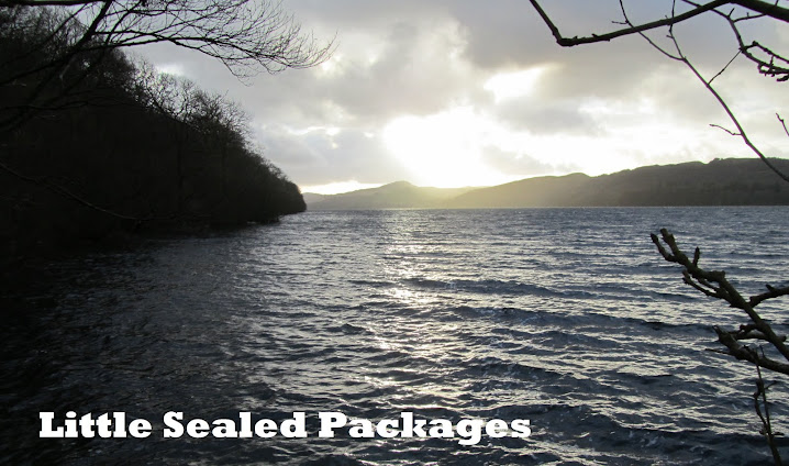
The photo above is taken from the top of the top lock, looking back towards the market town of Bingley.

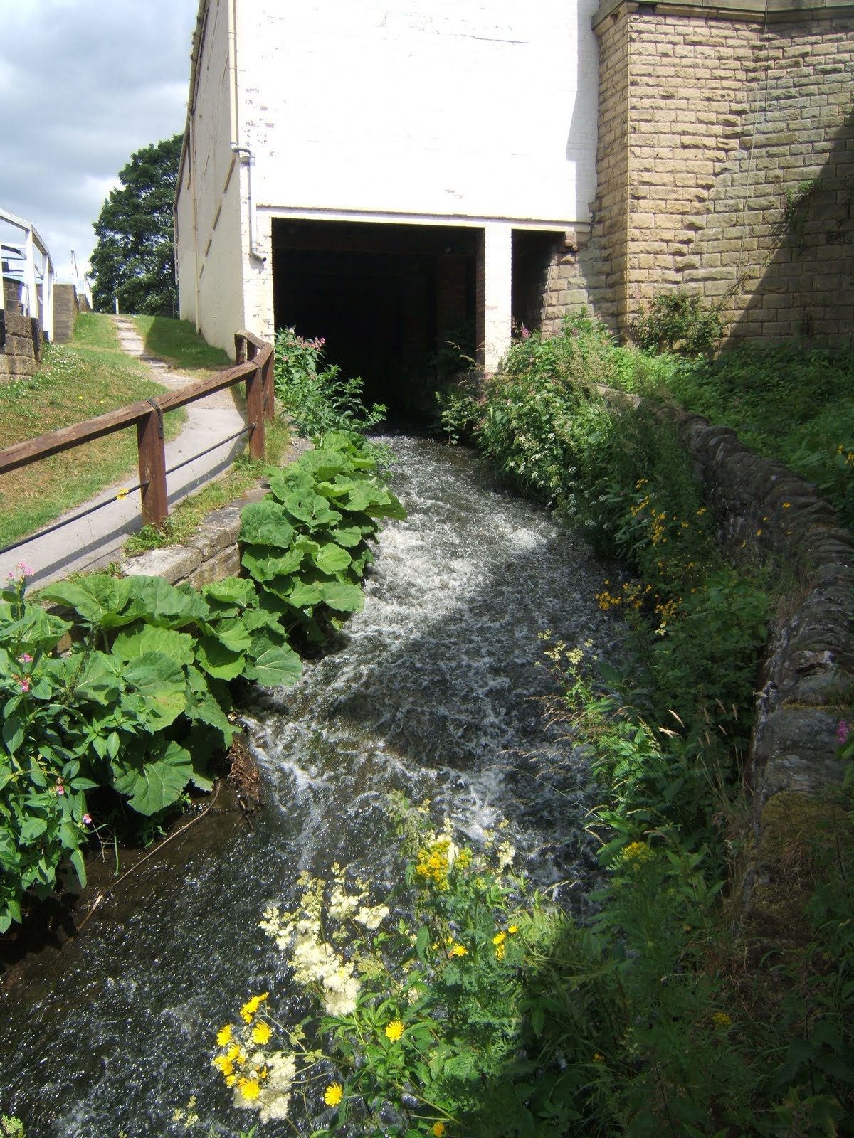
And this is the view from the top lock looking the other way.


For the more classic view from the bottom and also a little more about the history of this lock on the Leeds Liverpool Canal, follow this link to JennyFreckles' blog, Saltaire Daily Photo.

To see more Y posts on Jenny Matlock's Alphabe-Thursday, follow this link.