Monday, 7 June 2010

River Trent


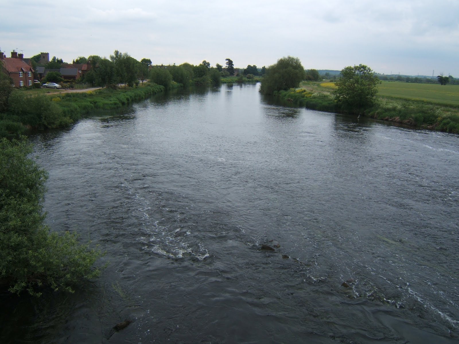
Looking west from Swarkestone bridge, the waters of the River Trent run relatively smoothly. By this point, they have flowed from their source between Biddulph and Biddulph Moor, through Stoke on Trent and Burton on Trent (all in Staffordshire) and skirted most of south Derby.


East, is looking towards Nottingham, around fifteen miles distant. Beyond Nottingham, the river turns more sharply north, heading for the Humber; in total, a length of 171 miles, making it the third longest in England.

It is interesting to notice that the water over this side of the bridge is choppy. I assumed that there were rocks below the surface. I was almost right.

Although Swarkestone Bridge is an ancient monument (see this post), the same is not true of the part of the structure which crosses the river itself. The ancient section is the causeway which is around 3/4 of a mile in length. The river bridge dates from the eighteenth century, replacing a much earlier version. It is the earlier bridge which is the cause of the rough water. When it was demolished to make way for this one, the rubble from the old bridge was allowed to fall into the waters of the Trent and was then left there; causing the previously calm water to suddenly have a bit of a rough ride. Regulations were obviously not as tight in those days!

The other thing we spotted across the east side of the bridge was this heron...


...which posed politely whilst keeping a sharp look out for fish! (It's a beautiful bird and much better standing here than trying to steal the koi carp from my uncle's pond!!)

Sunday, 6 June 2010

Poppies and rape


All around here, the fields are full of ripening oilseed rape, destined to join the mix of ingredients which make the margarine and oils we use in our food. Beautiful to look at, it has its own distinctive scent which hangs heavily in the air; so much so that it is not unusual to know that a field of rape is close by before it can actually be seen. The bright yellow fields are, unfortunately, murder for hay fever sufferers.

I was drawn to this particular field by the poppies; a splash of bright red surrounded by a sea of yellow.


More were nestling along the edges (along with a few patches of cow parsley).


Saturday, 5 June 2010

Cow parsley


There are lots of wildflowers about along the edge of the Trent and Mersey canal, adding splashes of colour and subtle fragrances. Some of them I knew the names for; others, I needed to be told by my far more knowledgable friend. I certainly recognised bullrushes, bright yellow buttercups, clear blue forget-me-nots and the pale purple clover. There was also a lot of white. Some of it was the may blossom of the hawthorn and blackthorn trees, which are showing beautifully at the moment. The rest was cow parsley.

Cow parsley is a wildflower which I love because of the connections it has with my childhood. When I was growing up, the busy road where my dad still lives, was little more than a quiet country lane. There were no houses opposite, only fields with hedgerows and all along the hedgerow was cow parsley. It was prolific and bloomed vigorously every year. For quite a few weeks, the whole roadside would be a show of white, gradually turning to seed which scattered ready for the following spring.

About four years ago, I collected some seeds from a patch of cow parsley and scattered them in the longer grass towards the bottom of my garden. The first year, I only had a couple of plants, but each year they have increased in number, until now, I have quite a show brightening up the shady place under the pear tree.

Friday, 4 June 2010

Trent and Mersey; bridge 15

This is bridge 15, around 7 miles from Shardlow, where the Trent and Mersey Canal flows out into the much more significant waters of the River Trent, sweeping by imperiously, on its way to join the Humber and, ultimately, the North Sea. I love the homely feel to the old brick bridges on the canal, and the way the view gradually opens up as you approach.


So, what's just round the corner?

I'm linking this post to Photo Friday ('Aqua'), where there are often some absolutely stunning photos to see.

Thursday, 3 June 2010

T is for Trent and Mersey

(Best viewed large)

This is Stenson Bubble on the Trent and Mersey Canal. When I was a teenager, I used to come here often. It was my playground.

Over the years, some things have changed; but the lock is still the same (more or less). The lock gates have been replaced and the little wooden plank footbridge, which nestled against the stone wall of the narrow roadbridge, is now a metal structure complete with handrail on the open side (probably not a bad idea considering the 20 foot drop into about 2 feet of water).

More boats come through too. As kids, we would hang around for hours, climbing all over the lock gates, waiting for a boat. When one did eventually come, we would be very willing helpers, watching the churning water either filling or emptying the between-gate section, depending on whether the boat was an upper or downer, and then putting our full weight against the gate bar, feet dug in against the ridges along the ground, straining to heave it open to allow passage.

This photo is taken from below the lock. You can just make out the lower gate through the bridge arch.


By the way, having had a canal as a childhood playground, I tend to assume that everyone understands the workings of locks, and was staggered to discover that the children in my first school (for whom 'Canal' meant the somewhat more significant waters of the Manchester Ship canal) had not the first clue about the lock system. If, like them, you are slightly puzzled, but want to know more, click here for a quick and easy animated explanation.

I'm linking this post to Jenny Matlock's Alphabe-Thursday. To see more contributions to this meme, click here.

Wednesday, 2 June 2010

Trent and Mersey


The Trent and Mersey Canal was engineered by James Brindley, although it was not completed until 1772, five years after his death. It was originally part of Brindley's concept of a 'Grand Cross' of inland waterways to link the Trent, Mersey, Thames and Humber.

As it's name suggests, this canal links two of those waterways; running for 93 miles between Preston Brook (where it joins the Bridgewater Canal and so links to the Mersey), and Shardlow (where it runs into the Trent Navigation).

Once opened, it served the pottery industry, carrying fragile porcelain out of the Potteries around Stoke-on-Trent and bringing in West Country china clay. It also transported coal, salt and beer. Trade contined into the 1960s, but was eventually moved onto roads and railways. 


Today, the canal is busy with cruise boats, as this canal forms part of both the Cheshire Ring (which also involves the Bridgewater, Macclesfield and Rochdale canals) and also the Four Counties Ring (Staffordshire, Cheshire, Shropshire and West Midlands). Down this end though, being only eight miles from Shardlow, most of the traffic is local.

Tuesday, 1 June 2010

Swarkestone Bridge

As I said in my post yesterday, Bonnie Prince Charlie's men may have drunk in the Dolphin Inn, but they can't have known that they were within a few short miles of the southernmost point of their journey, which came here, 6 miles south of Derby, at Swarkestone Bridge.


Built in the 13th century, this bridge remained the primary Midland crossing over the River Trent for around 300 years. The bridge itself is almost a mile long and has 17 arches, the reason for this being that the river was edged by an area of wetlands over which the bridge extended; more like a causeway than a bridge proper.


Being a major crossing made it a strategic location in a military campaign. In 1643, it was defended (unsuccessfully) by the Royalists against the Parliamentarians and, in 1745, the advance guard of the Jacobean rebellion was sent here to take control.

The Jacobean army was not strong and, although enough clansmen had been roused to march with Prince Charles Edward Stuart, his generals were looking for support from the south or from France. As this appeared to be unforthcoming, the generals decided to retreat (against the wishes of their leader).

What they did not know was that the English were singularly unprepared for an invasion with most of their troops abroad and King George himself preparing to flee to Germany just from the news of the Jacobean marching. If the march had continued, it would almost certainly have been successful and English history would have taken a very different path. (One wonders if this is one of those 'fixed points in time'. Dr Who fans will understand.)

As it stands, all we have is a slightly overgrown cairn, erected to mark the southernmost point of the march of the Jacobean rebellion.