Showing posts with label Swarkestone Bridge. Show all posts

Monday, 7 June 2010

River Trent


Looking west from Swarkestone bridge, the waters of the River Trent run relatively smoothly. By this point, they have flowed from their source between Biddulph and Biddulph Moor, through Stoke on Trent and Burton on Trent (all in Staffordshire) and skirted most of south Derby.


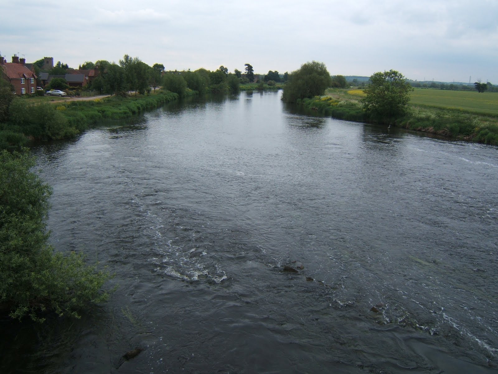
East, is looking towards Nottingham, around fifteen miles distant. Beyond Nottingham, the river turns more sharply north, heading for the Humber; in total, a length of 171 miles, making it the third longest in England.

It is interesting to notice that the water over this side of the bridge is choppy. I assumed that there were rocks below the surface. I was almost right.

Although Swarkestone Bridge is an ancient monument (see this post), the same is not true of the part of the structure which crosses the river itself. The ancient section is the causeway which is around 3/4 of a mile in length. The river bridge dates from the eighteenth century, replacing a much earlier version. It is the earlier bridge which is the cause of the rough water. When it was demolished to make way for this one, the rubble from the old bridge was allowed to fall into the waters of the Trent and was then left there; causing the previously calm water to suddenly have a bit of a rough ride. Regulations were obviously not as tight in those days!

The other thing we spotted across the east side of the bridge was this heron...


...which posed politely whilst keeping a sharp look out for fish! (It's a beautiful bird and much better standing here than trying to steal the koi carp from my uncle's pond!!)

Tuesday, 1 June 2010

Swarkestone Bridge

As I said in my post yesterday, Bonnie Prince Charlie's men may have drunk in the Dolphin Inn, but they can't have known that they were within a few short miles of the southernmost point of their journey, which came here, 6 miles south of Derby, at Swarkestone Bridge.


Built in the 13th century, this bridge remained the primary Midland crossing over the River Trent for around 300 years. The bridge itself is almost a mile long and has 17 arches, the reason for this being that the river was edged by an area of wetlands over which the bridge extended; more like a causeway than a bridge proper.


Being a major crossing made it a strategic location in a military campaign. In 1643, it was defended (unsuccessfully) by the Royalists against the Parliamentarians and, in 1745, the advance guard of the Jacobean rebellion was sent here to take control.

The Jacobean army was not strong and, although enough clansmen had been roused to march with Prince Charles Edward Stuart, his generals were looking for support from the south or from France. As this appeared to be unforthcoming, the generals decided to retreat (against the wishes of their leader).

What they did not know was that the English were singularly unprepared for an invasion with most of their troops abroad and King George himself preparing to flee to Germany just from the news of the Jacobean marching. If the march had continued, it would almost certainly have been successful and English history would have taken a very different path. (One wonders if this is one of those 'fixed points in time'. Dr Who fans will understand.)

As it stands, all we have is a slightly overgrown cairn, erected to mark the southernmost point of the march of the Jacobean rebellion.