Showing posts with label River Derwent. Show all posts

Monday, 24 January 2011

Limestone landscape


I love dry stone walls and I love farm buildings, so taking this photo was a no brainer for me.


Whereas here, it's not so much the wall as the gap in the wall, which draws me in.


In and down, through the woods and into the valley bottom. ..


...and up onto the far hillside.

Sunday, 23 January 2011

The Derwent Valley; Ambergate


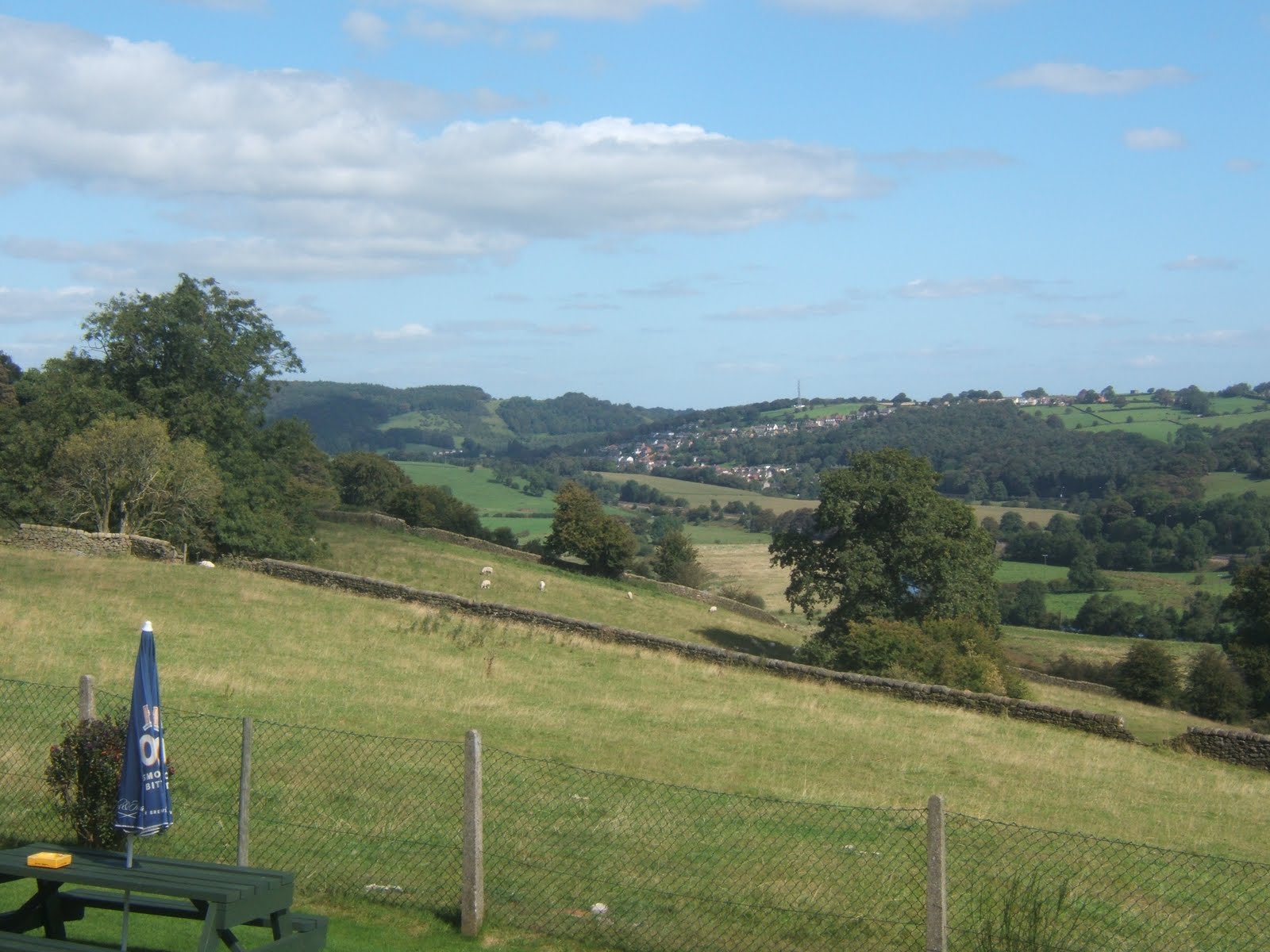
Above the town of Belper, is a pub called The Hill Top, perfectly positioned to give panoramic views over the Derwent Valley.  In addition to the river itself, the valley is occupied by the A6 and the mainline railway, both of which give access to the north from Derby. This train line is the one which I travelled on my day trip to Sheffield. 

There are settlements all along the road, including the large village of Ambergate, which grew up around the confluence of the river Derwent and its tributary, the Amber. The Amber, obviously, forms one part of the present name of this village. The remainder came in 1820, with the opening of a turnpike road between Belper and Cromford. The toll gate which stood on the junction of the present day A6 and A610, was named Amber Gate.This, of course, quickly encompassed the settlement too.

Incidentally, the stone posts of the gate still remain, though not in their original location. They were preserved and now stand near to the White House Inn on the A6.


Once home to a row of large lime kilns and, in 1876, the site of the newly opened Richard Johnson and Nephew wireworks, Ambergate's modern claim to fame is that it was the first place in Europe to have a fully operational electronic telephone exchange. (1966).

Sunday, 30 May 2010

Belper Hilltop


Belper, the village which exploded into a town, thanks to the mills of Jedediah Strutt, is nine miles north of Derby up the Derwent Valley. In the time of Strutt, it grew to have the second largest population in Derbyshire, a position which has now been claimed by Chesterfield (of the crooked spire). The centre of Belper town is in the valley, close by the river and the main mill, but the residential areas have spread up the valley sides onto the surrounding hills.


Towards the top of one steep hill is, the very appropriately named, Belper Hill Top pub. It isn't one of the towns trendy establishments (they tend to be in the centre), but this place does a very good midweek lunchtime offer on meals . So, on a day when I am not working, my Dad, aunt, uncle and I sometimes head up here for lunch. The food is always good...

...and, I'm sure you'll agree, the views are beautiful.


Saturday, 29 May 2010

Jedediah Strutt


Jedediah Strutt is the fourth (and last) of the statues above the shop which was the original Boots the Chemist in Derby, and he actually was born in Derbyshire; to be precise, in South Normanton, in 1726. His parents were farmers, but Strutt is yet another son of Derbyshire who is famous because of his association with the textile trade; being the first to refine a frame capable of making a ribbed stocking.

For a while, his frame was in use at the Derby Silk Mill, preparing silk thread to be made up into cloth, but in 1771, Strutt formed a partnership with Samuel Need and Richard Arkwright to build a cotton mill in Cromford, which combined the technologies of the Strutt Derby Rib with the Arkwright Water Frame.

Following this success, Strutt went on to build mills along the Derwent Valley; in Belper in 1778 and Milford in 1782, both accompanied by a row of substantial houses for his workers; just one of the reasons he was considered to be a good employer. Over time, Strutt built a total of eight mills in Belper and the village grew to a population of 10,000 , becoming the second largest town in the county after Derby.

Strutt died in 1797 and is buried in a vault under the Unitarian Chapel he had built in Belper.

Wednesday, 12 May 2010

Wigwell


Continuing on past the Leawood Pump House, the Cromford Canal crosses over the river Derwent by means of the Wigwell aqueduct (which is also known as the Leawood Aqueduct and the Derwent Aqueduct). This triple-named aqueduct is an 80 yard span which carries the canal 260 feet above sea level and 30 feet above the much faster flowing waters of the Derwent; from where it looks surprisingly like an ordinary bridge - click here to see.


During construction of the Canal, two aqueducts caused problems. In January 1792, the (now demolished) Amber River aqueduct failed and, in August 1793, the spandrel walls of this aqueduct parted, causing a split along the length of the arch. In his report, William Jessop, the main engineer, blamed the Crich lime being used in the morter, claiming that it was unusually pure and had delayed the setting of the mix. Later engineers are of the opinion that the spandrels were simply too thin to withstand the horizontal forces imposed by the water. To rectify the problem, Jessop had the arches partially demolished and steel bars installed as reinforcement. This he did at his own expense, so it is probably fortunate for him that the finished canal did prove a financial success (and, to his credit that the aqueduct is still in good working condition to this day)! 

PS: Lesson learned this morning ... how to spell aqueduct!

Tuesday, 11 May 2010

Leawood Pump House


The Leawood Pump House is at the end of the Wigwell Aqueduct which carries the Cromford canal over the River Derwent, 30 feet below.

Although the canal itself opened in 1794, the pumping house was not built until 1849, the reason being that the water to supply the canal had originally been taken from Cromford Sough, which was itself fed with water from the local lead mines. However, the mines dug to deeper levels and the water supply dried up. The Company was then forced into building the pumphouse to take water from the River Derwent.

The pumphouse was capable of shifting an enormous amount of water, with a pump rate of 800 gallons (or 4 tons) each stroke, at a speed of three strokes per minute. This amount was required to maintain the water in the canal at a navigable level. Now, the canal is noticably shallow.

The pumphouse is still in working condition and can be viewed on certain weekends each year, when it is brought up to full steam. Usually, these occasions begin around Easter and go through at one a month, plus bank holidays, until a discovery weekend in late October. Viewings are free.

On pump days, the water taken from the Derwent is eventually returned to the river.

Saturday, 8 May 2010

Cromford Wharf


Cromford is a village within the steep sided Derwent Valley, about 19 miles north of Derby and 3 miles south of Matlock. Once at the heart of the industrial revolution and most famous for its links with Sir Richard Arkwright, who established a water powered cotton spinning mill here in 1771, this is now a small rural community of around 1,800 inhabitants, mainly dependent on tourism and the local quarry for much of its economic wellbeing.

A lot of visitors come here to experience the history of the area, one part of which is the Cromford Canal. Running 14.2 miles, from Cromford to the Erewash Canal at Langley Mill, the Cromford Canal was designed by William Jessop and opened in 1794. The main incoming commodity was coal, needed to feed the growing industrialisation of the area, while the outgoing cargoes were limestone for the iron industry, lead from Wirksworth and cotton from the mills. The final cost of the canal was £43,697 (which, in today's money, is equivalent to roughly £3,910,000!), but, once opened, the enterprise proved a financial success.

The buildings pictured are the Wharf warehouses at the Cromford terminus of the canal, opposite Richard Arkwright's Cromford mill. Constructed in 1824 as a storehouse for goods awaiting transportation by boat, the left of the two now houses a wildlife shop and a cafe, which served a very pleasant mug of fairtrade coffee and a rather tasty parsnip, swede and carrot soup. The other is leased by the Arkwright Society and contains two classrooms for educational visits.

While we were there, we also witnessed the canal being used for canoeing, with boats full of excited children disturbing the peace of the ducks! It looked very good fun!


Tuesday, 16 February 2010

Low profile span


Derwent Street crosses the river by means of Exeter Bridge. The original, designed by James Trubshaw in 1850, had 3 arches, but was demolished in 1929 as the first project in the Civic Redevelopment Scheme which (I am learning) saw so many major changes in this area of Derby. This single span concrete bridge was designed by Charles Herbert Aslin of the City Architect's Dept and opened on March 13th 1931 by Herbert Morrison, who was the then Minister for Transport.

Whilst digging through web pages (some extremely informative and others considerably less so) I have come across two gems which I found particularly interesting. The first is that the four posts at the ends of this bridge (two are just visible to the right of picture) are adorned with bas relief, head and shoulder sculptures of four famous Derbeians. I am beginning to think that I walk round this city with my eyes wide shut! In spite of having crossed this bridge on a number of occasions (including yesterday), I have failed comprehensively to notice these sculptures! I will investigate at my earliest convenience!

The other gem made me howl with laughter. During the construction of this bridge, the civil engineers conducted a test to ensure that it would be strong enough to cope with the anticipated volume of traffic. Health and safety buffs look away now! The engineers drove a procession of traction engines, steam rollers and heavy lorries across the newly constructed span. It does rather beg the question about what would have happened had the bridge NOT lived up to expectation!

Monday, 15 February 2010

Derventio


By the time it meanders through Derby, the River Derwent is reaching the end of it's 50 mile course. In a few short miles it will reach Great Wilne on the border with Leicestershire, and mingle its waters with those of the significantly larger River Trent.

It is really thanks to the river that Derby exists at all. The Romans built a fort on it's banks, in the area now known as Chester Green; chester being a Roman word meaning 'settlement'. The Roman fort was named Derventio. Following on from that, there is evidence of Saxon settlement, but Derby really began to grow during the time of the Vikings, by which time it was known as Deoraby, meaning 'The Place of the Deer'.

At one point in its journey through Derby, the Derwent passes behind the Council House. From the steps here, can be seen the weir, which stretches the entire width of the river, and also the Inner Ring Road (at this point called St Alkmund's Way, after the church which had to be relocated in order for it to be built).

The old bus station used to be just down from here and a walk by the river (or, in my case, usually a hop, skip and jump from step to step) was often the treat dangling at the end of a childhood shopping expedition to town. These days, I tend to walk along here much more sedately!

Footnote 16.2.10 - The weir was built across the river to form the Derwent Basin, providing an access point for the now disused (and mostly eradicated) Derby Canal, which was built to link Derby with the Trent and Mersey Canal. I will investigate this further for a later blog.