Wednesday, 15 June 2011

Ingleby

My personal challenge for this round of Miss Jenny Matlock's alphabe-Thursday is to post about a location within the borders of my own county of Derbyshire, UK, for each letter of the alphabet.


Look for the letter, to see where I am.


I is for Ingleby.

-------------------------------------------------------------------------------------------------------------

When I was teenager, we would set out for the day and ride all over South Derbyshire on our bikes. We didn't leave a route plan and no one worried about us. Ingleby is one of the many places we would ride through, losing ourselves in the twisting country lanes which meander across this area.

To call it a village would be an inaccuracy. Although Ingleby can trace its history back to the Domesday book, it is still too small to be called a village. It is officially termed a hamlet; a word which derives from the Anglo Saxon hamelete and has come to denote a community too small to justify the building of a church.  At the time of Domeday, Ingleby is listed as being part of the considerable acreage belonging to Nigel of Stafford.

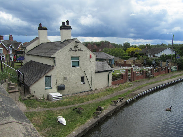
On the eastern edge of the village, there is a pub (more about that next week) and a farm.


I love this farmhouse!


Moving further into the village, there are a few small groups of cottages....


...and a gallery.


The building housing the gallery was originally a stable for shire horses. It was built in the 18th Century and was part of a working farm on the Foremarke Estate.

The gallery holds exhibitions throughout the year, each one lasting for two weeks with a four week special at Christmas. Artwork exhibited includes jewellery, ceramics, sculpture, metalwork and glassware from both featured artists and regular exhibitors.  The focus is on displaying work showing diverse styles and skills.


The small public building squeezed onto the space by the roadside displays the 1914-19 war memorial, listing those from Ingleby, Foremarke and Milton, who died in the 'Great War'. It also sports the village notice board and the post box.


GR for George Rex - George V (1910 - 1936).


I think this is a natural well, but I couldn't find any information to confirm that.


Finally, I spotted one bonus delight as I was leaving the hamlet...


...field after field of bright red poppies.


What a beautiful sight!

Tuesday, 14 June 2011

Any excuse to snap a canal!

We were out in the car, meandering our way home from lunch, when Dad had to stop to make a phone call. The lay-by he pulled into was right next to the canal bridge.

"Back in a sec..."


I like canals :)

Monday, 13 June 2011

Look what we found in the far corner of the garden centre

Tucked away in a corner of Byrkley Garden Centre near Burton on Trent, Staffordshire, were these hungry fellows; noses down, snuffling up a bucketful of pellets which had just been tossed onto the floor of their sty. Mum's certainly got her work cut out with that lot!


In the field next door were a couple of sheep in mid moult! I love their curly coats!


I'm no expert on sheep breeds, but I've searched through my sheep breeds identification guide and I think that the chappie below may be a Soay. As for the two above..??


Sunday, 12 June 2011

Of unphotographed fire engines and thwarted kite flying


Right in the heart of Nantwich is the church of St Mary which dates back to the 14th century (with many later alterations and additions). It is an English Heritage Grade 1 listed building and has been described as the 'Cathedral of South Cheshire'.

It is constructed in the cruciform shape and made of red sandstone, with an octagonal tower unexpectedly visible from odd little corners of the town.

As we walked by, a funeral was about to take place. The deceased had obviously once been a fireman because the hearse was accompanied by a vintage fire engine and, lined up outside the main door, a six man guard of honour. I'd have loved to have photographed the fire engine, but it seemed a little inappropriate!

Someone rather less than pleased at the sight of the funeral was a youth who turned the corner towards the church just as we reached the end of the green. He was obviously hoping to fly his (rather small and nontechnical looking, cartoon character covered) kite from the grass, and growled in disgust to his companions at the sight of the cortege. 

Better luck next time matey!

Saturday, 11 June 2011

Weaving through Nantwich

Nantwich is built on the banks of the River Weaver. The Weaver is 50 miles long, rises on the hills of West Cheshire and flows in an arc across the Cheshire Plain, northwards towards the River Mersey.


This was the site of Nantwich Mill, used to grind corn and produce cotton. The channel is the old mill race, where faster flowing water was channelled to drive the mill wheel. Around the other side of mill island is a natural loop in the course of the river.


The single span stone bridge dates back to the early 19th century.


At this stage of its course, the Weaver is not navigable, although a series of parliamentary bills in the 17th century allowed for the improvement of the river downstream and, since the construction of the Manchester Ship Canal, the river ends its course in that waterway.


Friday, 10 June 2011

Black and whites

On Tuesday, I went to visit a good friend who now lives about 50 miles away from Derby, in Nantwich.

The market town of Nantwich, in the Borough of Cheshire East, dates back to Roman times and is recorded in the Domesday book as having eight salt houses, an indication of its primary function at that time. The name wich or wych denotes a brine spring or well and the salt produced here was used as a preservative and as a condiment. In medieval times, Nantwich was the most important salt town in the country and enjoyed much prosperity as a result.

In 1583, a fire destroyed much of the eastern side of the town. Queen Elizabeth I took a personal interest in the rebuilding, even contributing to it financially. As a result, many of the buildings are of the 'black and white' Elizabethan style and Nantwich is lucky that a number of these have survived to the current times. In fact, Nantwich has the second largest number of historic buildings in the country; the first largest being in its county town of Chester.

I snapped just a selection of the black and whites which I spotted.


The plaque pays homage to the part played by Queen Elizabeth I in the rebuilding.

The building below houses a bookshop and cafe where Lisa and I enjoyed a delicious lunch of loaded skins with salad and home made coleslaw!


This building is the Cheshire Cat Hotel, named (of course) after the character from Alice in Wonderland; not an unusual name for a pub in Cheshire!


It really is quite incongruous how the black and whites are sandwiched between buildings of so many other styles; often being towered over by their newer neighbours. Nevertheless, it works and the town centre has a charm which is lovely to experience.

Thursday, 9 June 2011

Hognaston

My personal challenge for this round of Miss Jenny Matlock's alphabe-Thursday is to post about a location within the borders of my own county of Derbyshire, UK, for each letter of the alphabet.


Look for the letter, to see where I am.


H is for Hognaston.

-------------------------------------------------------------------------------------------------------------

The village of Hognaston has been around since the times of the Domesday Book (1086), at which point it was known as Ockenavstun.

The settlement began as a small cluster of houses, built by people attracted to the water supply here. There is a series of wells along the road through the village; supplied by fresh spring water. Over the years, the village has grown and changed. Aerial photography shows evidence of medieval field structures and of once existing houses, now demolished.

Part of the reason for the growth of the village is that the main street was once the Manchester to London road and would have been busy during the time of stage coach travel!


I used to come through here fairly regularly, but since the opening of the reservoir at Carsington, the village has been by-passed, meaning that it has returned to being much quieter and relatively free of traffic. However, if you look carefully, you can see that the village has a bus service. (In the top photo, there is a bus stop; the small stone structure in the top corner of the first sundial shot - two below - is the bus shelter.) 


The vast majority of the buildings are built of local stone (limestone) and many properties are bounded by dry stone walls. This farm is on the main street, just below the church.

The current population of the village is around 300. In the year 2000, a Millennium sundial was placed in the village. Around the edge, are names of the villagers and inside, is a time capsule.


This is just one of the lists on the band circling the sundial.


Below, is the view looking south, down the road from the sundial.


In 1982, a new Village Hall was opened. It was constructed almost entirely by the villagers. The previous village hall was a tin roofed structure erected during the second world war. This hall began life as a stone building belonging to Severn Trent Water Company. The building was purchased by the villagers and demolished stone by stone. A new hall was then erected on the site, making use of stone from the original building.


Notice the polyethylene oil tank in the side garden of this house. This is not unusual in villages without a gas supply. Deliveries of oil provide the fuel for central heating systems.


The church of St Bartholomew stands raised above the main street.


The church dates back to the 12th century and two of the bells were cast at the beginning of the 13th century. The other three bells and the clock were given to the church by John Smith & Sons, the famous clock-makers who still work out of Derby. The original John Smith lived in the village.


The doorway of the church is early Norman!


The village no longer has a school or shop, but it is still served by a local pub; The Red Lion, which dates back to the seventeenth century when the village was on the main coaching and pack horse route.


Pint, anyone?